Introduction
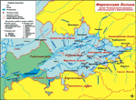
 The Fergana Valley or Farghana Valley (Uzbek: Farg’ona vodiysi, Russian: Ферганская долина) is a region in Central Asia spreading across eastern Uzbekistan, Kyrgyzstan and Tajikistan.
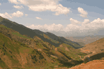
The most important part of the province is a rich and fertile valley, in an altitude of 1200 to 1500 ft (400 to 500 m), opening towards the southwest.
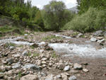
The valley owes its fertility to two rivers, the Naryn and the Kara Darya, which unite in the valley, near Namangan, to form the Syr Darya.

The streams, and their numerous mountain effluents, not only supply water for irrigation, but also bring down vast quantities of sand, which is deposited alongside their courses, more especially alongside the Syr Darya where it cuts its way through the Khojent-Ajar ridge, forming there the Karakchikum. This expanse of moving sands, covering an area of 750 km², under the influence of south-west winds, encroaches upon the agricultural districts.

The Fergana Valley is one of the most densely populated areas of Central Asia and is a major producer of cotton, fruit, and raw silk.
Among the mineral deposits that are exploited are coal, oil, mercury, antimony, and ozocerite.
Sedentary agriculture has been practiced for many centuries in the Fergana Valley, which also lay on one of the main trade routes to China.
The valley was conquered by the Arabs in the 8th century, by Genghis Khan; in the 13th, and by Timur (Tamerlane) in the 14th.
The khans of Kokand ruled it from the late 18th century until it was taken by Russia in 1876.
The major Fergana Valley’s cities are:
– Fergana
– Margilan
– Andijan
– Kokand (Quqŏn)
– Namangan
